S14 Senderos de Gran Canaria
Cruz de Tejeda - Talayón - Teror

This route starts in Cruz de Tejeda, juncture of highways and roads, apart from being a dividing line
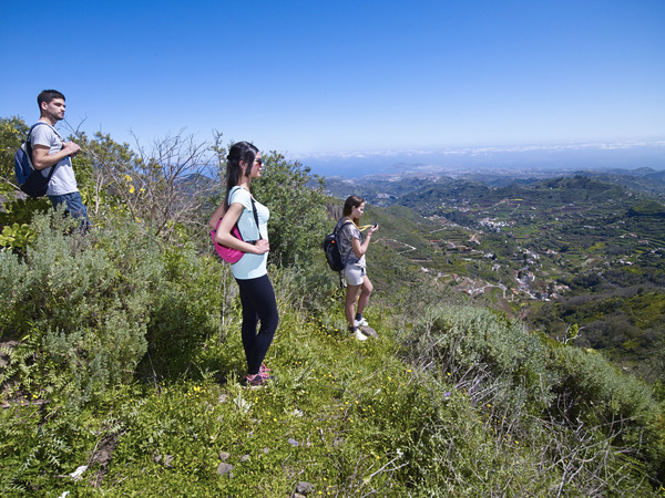
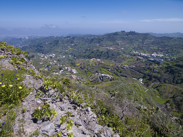
of the townships of Vega de San Mateo and Tejeda. Because of its strategic position, it is one of the main sites of the centre of the island, to visit and to trade (exchange of goods) and of course, landscape contemplation because it is visible a great part of the Caldera de Tejeda and majestic rocks.
Cruz de Tejeda, is accessible by public transport. In addition, there are is an Insular Bureau of Tourism and various accommodation facilities and where you can enjoy the rich canary cuisine.
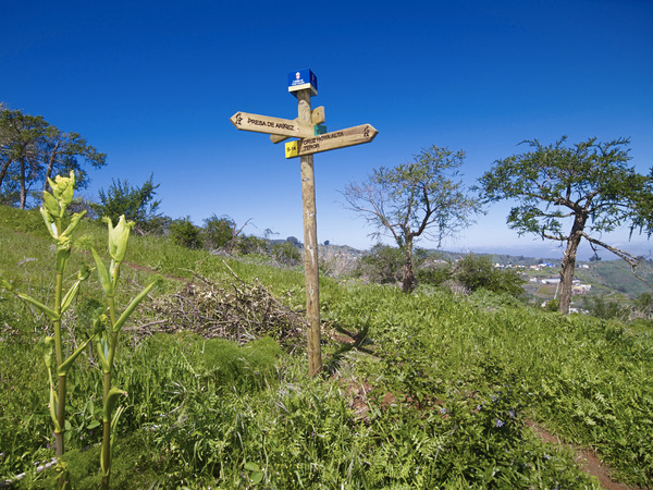
In the parking area (behind the Parador Nacional de Tejeda) begins two paths. One takes the path towards Artenara NW, and our route heading NE, to Teror . There are wooden signs and indicating maps.
The dirt road ascends for about a kilometre, to the GC-150 road, Degollada Cruz Chica, between yellow brooms, sage, canary pines, etc.
When you reach the asphalt, you must take the right. This time the direction is E-NE, and after traveling about 800 meters, leaves the asphalt to the left to starting our steep descent in search of El Talayón. Before GC-230 cross the road, at the junction with the GC-400.
This route which is done in other townships, is divided into the following sections:
Section 1: Cruz de Tejeda-El Salviar-Degollada de Cruz Chica.
Distance: about 1000 metres. Approximate time: 20 minutos.
Section 2: Asphalt road GC-150- Lomo de la Almagrera - Hoya de Galaz - Cruce de Aríñez (GC-230).
Distance: about 1640 metres. Approximate time: 30 minutes.
Section 3: Montaña Blanca-Las Gramas-El Talayón.
Distance: about 2000 metres. Approximate time: 40 minutes.
Path in Teror
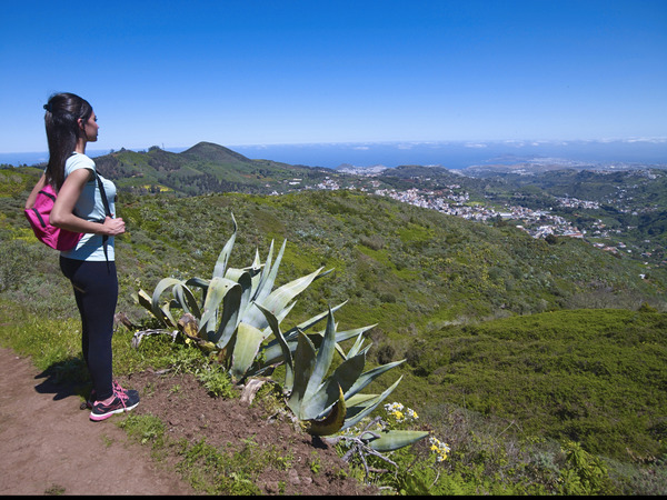
Climbing the Mountain of "Talayón" is a privilege. Its panoramic 360 º feet allows us to see the whole area, even on clear days it is possible to see the Las Canteras beach and volcanoes of La Isleta. There is a cross on it. It also acts as the boundary between the towns of Valleseco, San Mateo and Teror.
Section 1: Risco de Las Tuneras-Montaña de Valerio.
Distance: about 2240 metres. Approximate time: 50 minutes.
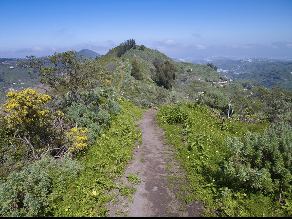
The stretch S-14 runs through the centre of the dividing ridge giving sight to both basins. Signalized perfectly, arriving to the area known as Mountain Valerio, where it crosses two small roads; the last one is the GC-214, which descends to the hamlet of Madrelagua. In a sharp bend, the road goes to the left to enter a stretch of land where we will find our next road, about 200 meters or so.
Section 2: Lomo de Silillo-Los Picachos-Montaña José Manuel-Cruz de Hoya Alta.
Distance: 1800 metres. Approximate time: 40 minutes.
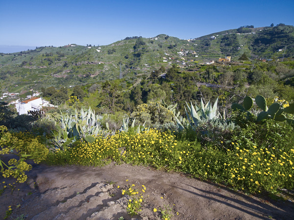
We now walk to our right leaving the dirt track and continue moving parallel to a stone of agricultural terraces, in some cases abandoned. The road goes through the middle of the hill until you reach an area where the rocks take on a special role. The colour of the earth denotes the land erosion. We are in El Picacho, where a road to the left goes down to the hamlet of La Culata and Teror appears. However, it is not our direction. We continue to the right, now in descent, to go round the mountain José Manuel (with a cross on its side) for its E-NE slope.
We are now decending, until we reach a fork, where we take a left turn onto the old cobblestone road with cement steps ascending in search of vineyards ,which allows us to see the other side.
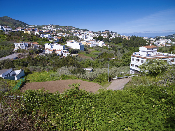
At this point, we will continue down the centre of the valley, now the earth is a striking red with abundant ferns that flank the road on both sides. Our destination is the huge Cruz de La Hoya Alta, where we can admire, from an authentic aerial perspective, the Villa Mariana.
Thus, we can see two crosses (a metal and a wooden one). The wooden cross is covered with flowers by the locales on the festive day “of the cross” (1 may) following an old tradition, and the metal cross glows at night, thanks to a generator housed in a small cave excavated in the zone.
Section 3: Lomo Verdugo- Parada de la Era- El Pedregal- Town centre of Teror.
Distance: 1700 metres. Approximate time: 40 minutes.
Next to the crosses, is another trail that takes us to the “Parada de la Era”, and allows us to continue toward a set of eucalyptus and the viewpoint of the Caidero.
When we take the main road (GC-42, which joins Teror San Isidro and San Mateo), we must walk to the left - direction Teror - about 250 meters on the asphalt. Now we have to pay attention to the route after 2 kilometre, we leave the asphalt to descend to the right by the path that passes a group of houses “El Pedregal.” We descend the steps until we come across the facades of some beautiful residential houses. Terminating in the “Paseo de Froilán”, where we turn left to enter the town centre of Teror.